
Field Spectroradiometers
Field spectroradiometers measure wavelength-resolved optical signals from vegetation, soils, minerals, water and engineered surfaces at the target location. This category brings together compact and integrated handheld instruments with broader full-range, high-resolution systems. Use the two subcategories to select according to wavelength coverage, spectral resolution, field of view, target geometry, reference method, portability and the level of field metadata or software control required.
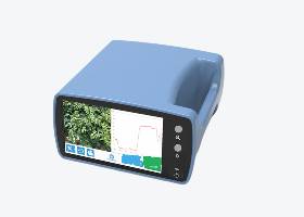
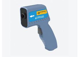
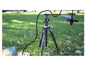
Online & Multi-Channel Field Spectroradiometers
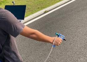
Full-Range & High-Resolution Field Spectroradiometers
Overview
Field spectroradiometry is used when a wavelength-resolved optical measurement must be made at the location of the target rather than after moving a sample into the laboratory. A system collects light from a defined measurement footprint and records its intensity across wavelength. Depending on the calibration, fore optics and measurement method, the resulting data can support spectral radiance or irradiance measurements, or reflectance calculated from target and reference readings.
A field spectroradiometer normally produces one spectrum from one measurement footprint at a time. This distinguishes it from a hyperspectral imager, which combines spectral and spatial information across an image. Point-based field spectra are valuable for target characterisation, spectral-library development, method validation and ground-reference measurements for drone, airborne or satellite remote sensing.
Reliable results depend on the complete measurement method, not only the detector. Illumination stability, target distance, viewing angle, field of view, surface heterogeneity, reference-panel condition, integration settings and the time between reference and target readings can all influence the recorded spectrum.
This category provides two selection pathways. Miniature and handheld instruments prioritise mobility and rapid visible-to-near-infrared field measurements. Full-range and high-resolution systems extend the workflow into the shortwave infrared and are intended for applications that require broader spectral coverage, fibre-optic sampling or finer separation of neighbouring spectral features.
Key Capabilities
- Collect point spectra directly from field targets under natural or controlled illumination.
- Support reference-based reflectance and calibrated radiometric workflows when the selected configuration is suitable.
- Compare visible and near-infrared systems with broader visible–near-infrared–shortwave-infrared instruments.
- Control the measurement footprint through field-of-view optics, probe geometry and working distance.
- Record repeated measurements for averaging, comparison and spectral-library development.
- Capture location, orientation or environmental metadata on appropriately configured instruments.
- Export spectra for further processing, visualisation and comparison with remote-sensing datasets.
Typical Applications
- Crop, pasture, leaf and canopy measurements.
- Forestry, ecosystem and plant-health research.
- Soil, mineral, rock and geological investigations.
- River, lake, coastal and ocean-colour studies.
- Ground-reference measurements for drone, airborne and satellite data.
- Outdoor material, coating, weathering and teaching studies.
Integration and Compatibility
A complete field workflow may require a characterised reflectance panel, interchangeable field-of-view optics, a fibre or contact probe, cosine diffuser, tripod, controlled light source, mobile device or computer, and suitable acquisition software. These items are not universal across all models, so standard inclusions and optional accessories must be confirmed for the selected instrument.
When field spectra will be compared with imaging data, record the acquisition time, location, illumination conditions, viewing geometry, target footprint and reference procedure. Matching the field measurement as closely as practical to the spatial scale and timing of the drone or satellite observation improves traceability and interpretation.
Why ScienceGears
ScienceGears can help researchers and technical teams in Australia and New Zealand define the measurement objective before selecting an instrument. Support can include discussion of wavelength range, spectral resolution, field of view, reference strategy, target distance, accessories, software, data export and field-deployment requirements, followed by configuration and quotation support for the chosen system.
Miniature & Handheld Field Spectroradiometers
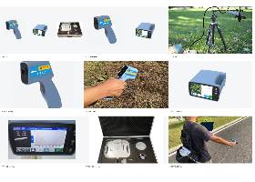
Choose this pathway when low carried mass, rapid deployment and straightforward point measurements are the main priorities. It contains the compact ATP9101 for operation through a connected phone or computer and the more integrated ATP9100F with an onboard touchscreen and camera-assisted targeting. It is the appropriate starting point when visible and near-infrared coverage is sufficient.
Full-Range & High-Resolution Field Spectroradiometers
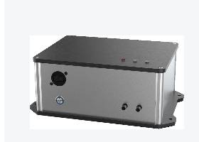
Choose this pathway when the work requires broader visible–near-infrared–shortwave-infrared coverage, fibre-optic probe measurements or higher spectral resolution. The current range includes the ATP9110-25H for field studies involving minerals, soils, vegetation, moisture-related features and remote-sensing validation where a transportable full-range system is more appropriate than a compact handheld instrument.
HOW TO CHOOSE
Begin with the required measurement quantity. Reflectance normally needs a suitable reference standard and a repeatable target/reference sequence, while radiance or irradiance measurements require the appropriate calibration and fore optics.
Next, decide whether visible and near-infrared coverage is sufficient. Choose the miniature and handheld pathway for rapid portable work where the important features lie within the VNIR region. Choose the full-range and high-resolution pathway when the research depends on shortwave-infrared absorption features, fibre-probe measurements or greater spectral discrimination. The widest wavelength range is not automatically the best choice if it adds unnecessary size, complexity or cost.
Then define the measurement footprint. Field of view, target distance, probe type and target uniformity determine whether the recorded spectrum represents the intended material or a mixture of target, soil, shadow and background.
Finally, compare field workflow requirements: standalone operation or connection to another device, battery duration, environmental protection, camera-assisted targeting, GPS and angle logging, software, file formats, reference panels and transport weight. Confirm the complete accessory and software package before ordering.
FREQUENTLY ASKED QUESTIONS
What is a field spectroradiometer?
A field spectroradiometer is an optical instrument that records signal intensity across wavelength from a defined target area outside the conventional laboratory. Depending on its calibration, optics and method, it may support radiance, irradiance or reference-based reflectance measurements for vegetation, soils, minerals, water, materials and remote-sensing studies.
How is a field spectroradiometer different from a hyperspectral imager?
A field spectroradiometer normally collects one spectrum from one measurement footprint at a time. A hyperspectral imager records spectra across many spatial pixels to create an image cube. Field spectra are commonly used to characterise specific targets, build spectral libraries and provide ground-reference measurements for interpreting or validating imaging data.
Does a field spectroradiometer measure reflectance directly?
The detector records a spectral signal from the target. Reflectance is generally calculated by comparing that signal with a measurement from a suitable reference standard collected under consistent illumination and geometry. The quality of the result therefore depends on the reference panel, measurement sequence, field of view and data-processing method as well as the instrument.
Do I need a full-range VNIR–SWIR instrument?
Not for every application. Visible and near-infrared coverage may be sufficient for many colour, pigment, vegetation and general surface-comparison studies. Shortwave-infrared coverage becomes important when the research depends on water-related absorptions or selected mineral, soil, vegetation and material features outside the VNIR region.
Why is a reflectance reference panel important?
A characterised reference panel provides a known optical response against which the target signal can be normalised. It helps account for the incident illumination and supports calculation of reflectance. The panel should be suitable for the required wavelength range, kept clean and measured using geometry consistent with the target reading.
How does field of view affect a measurement?
Field of view defines the angular area accepted by the instrument. Together with the working distance, it determines the physical target footprint. A broad field of view collects from a larger area but may mix the target with soil, shadow or background. A narrow field of view isolates a smaller target but requires more careful positioning.
Can field spectroradiometers be used for water measurements?
Yes, but water measurements require careful method design because the useful water-leaving signal may be weak and affected by sky reflection, sun glint, waves, viewing angle and changing illumination. The field of view, measurement geometry, reference procedure and timing should be selected specifically for the site and research objective.
Can field spectra be compared with drone or satellite data?
Yes, when the field method is designed for that purpose. Record the acquisition time, position, illumination, viewing geometry, target footprint, reference measurements and processing steps. The field target should also be sufficiently uniform at the spatial scale represented by the airborne or satellite pixel.
CLOSING SUMMARY
Field spectroradiometers provide a practical connection between laboratory spectroscopy and optical measurements at the target location. The appropriate pathway depends on the required wavelength range, spectral resolution, measurement geometry, reference method and field workflow. ScienceGears can assist researchers across Australia and New Zealand with subcategory selection, accessory review, configuration and quotation support.